A Park Shaped by Rivers and Hills
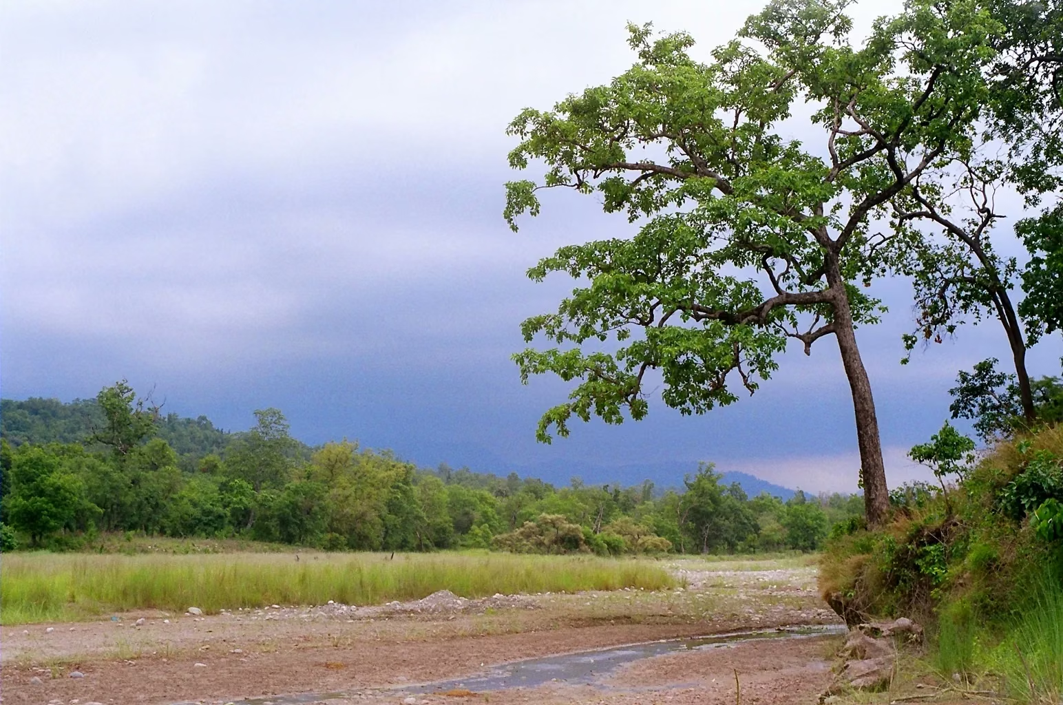
Rajaji National Park occupies a distinctive position in Uttarakhand's landscape: a long, narrow stretch of forest, grassland and river habitat running along the Shivalik foothills where the lower Himalayan range meets the Gangetic plain. This is not a compact, circular park you can drive around in a day. It is an elongated landscape shaped by the Ganga river system and the rising terrain of the Shivalik hills — a geography that creates distinct zones, diverse habitats and very different safari experiences depending on where you enter.
Understanding the park's general layout before you visit helps you choose the right gate, set appropriate expectations and appreciate how the landscape shapes the wildlife you encounter. This guide explains Rajaji's geography in general terms, describes how the major ranges and gates relate to that geography and provides a practical framework for choosing where to enter.
An important caveat: park boundaries, zone designations and administrative details can change with Forest Department decisions. This guide describes the park's general geography and layout rather than current administrative specifics. Always confirm current range boundaries, gate access and zone availability before planning your visit.
The North-South Spread Along the Shivalik Foothills
Rajaji's overall orientation runs roughly along the Shivalik foothills, with the terrain rising from the Gangetic plain into the lower hills. This north-to-south spread means the park covers a range of elevations and habitat types — from flat, riverine floodplains near the Ganga to forested hill slopes at higher elevations. This gradient is not just topographic; it creates a sequence of distinct habitat zones within the park, each supporting different wildlife communities.
Lower elevations: river and grassland
The lower areas of the park, closest to the Ganga and its tributaries, feature riverine forest, grassland, marsh and open floodplain. This is where elephants are most commonly seen, where gharial and mugger crocodile inhabit the river channels, where otters fish along the banks and where winter migrants congregate. The flat terrain and open habitat make this the most visually accessible part of the park — visibility is better, wildlife concentrations are higher near water and safari routes tend to follow the river corridors.
Mid-elevations: Sal forest and woodland
Above the river corridor, the terrain rises into the characteristic Sal forest that defines much of Rajaji's landscape. Sal (Shorea robusta) is the dominant tree species in the Shivalik foothills, creating a semi-evergreen canopy that provides habitat for leopard, sloth bear, langur, hornbill, woodpecker and a rich community of forest-dependent species. The Sal forest is denser and more closed than the riverine areas, which means visibility is lower but the sense of immersion in the forest is stronger. Safari routes through Sal forest are narrower, more winding and more dependent on the guide's ability to read the environment.
Higher elevations: hill terrain and mixed forest
At the park's higher edges, where the Shivalik hills rise more steeply, the forest transitions to mixed deciduous and, in some areas, pine-dominated terrain. This hill terrain is leopard and black bear habitat, with rocky outcrops, scrubby undergrowth and elevation changes that suit these more elusive species. Safari access to the highest areas may be limited depending on the zone, and the terrain is generally less visited by standard jeep safaris.
Where the Cities Sit Relative to the Park
Rajaji's proximity to major Uttarakhand cities makes it one of India's more accessible tiger reserves, but the city-to-gate distances vary significantly depending on which range you are targeting.
Haridwar
Haridwar sits at the park's eastern edge, close to the Chilla and Motichur ranges. The city is a natural gateway for visitors approaching Rajaji from the plains, and several safari gates are accessible from Haridwar within a relatively short drive. The proximity to the Ganga is both geographic and cultural — the river that flows through Haridwar is the same river that shapes Rajaji's wildlife corridors.
Rishikesh
Rishikesh is positioned along the Ganga upstream from Haridwar, near the park's central and western ranges. Several gates are accessible from Rishikesh, and the city is a common base for visitors who want to combine a safari with Rishikesh's broader appeal. The drive from Rishikesh to certain gates takes you through terrain that transitions from urban to rural to forest — a reminder of how closely human settlement and wilderness coexist in this landscape.
Dehradun
Dehradun, the state capital, lies to the northwest of the park. Some of Rajaji's western and northern ranges are accessible from Dehradun, and the city serves as a gateway for visitors approaching from that direction. The drive from Dehradun to certain gates passes through the Shivalik hills, offering a preview of the terrain you will enter on safari.
The Major Ranges and Their Character
Rajaji is managed in distinct ranges, each with its own entry gate, terrain character and wildlife profile. While administrative designations can change, the following descriptions reflect the general character of the park's principal ranges.
Chilla Range
The Chilla range, accessed through the Chilla gate, is one of Rajaji's most popular safari areas. The terrain includes a mix of riverine habitat, grassland and Sal forest. The proximity to the Ganga and its tributaries makes this a strong area for elephant viewing, river species observation and waterbird sightings. The grassland areas support nilgai, wild boar and peafowl. Chilla's accessibility from Haridwar makes it a common first choice for visitors, and the varied habitat offers a broad introduction to the park's wildlife.
Motichur Range
The Motichur range, accessed through the Motichur gate, covers terrain that includes significant Sal forest and mixed woodland. This range is known for its forest character, which provides habitat for leopard, sloth bear, langur and a rich bird community. The terrain is more undulating than the riverine areas, and safari routes wind through forest that feels deeply interior. Visitors who want a forest immersion experience — dense canopy, filtered light, the sound of hornbills overhead — may find Motichur's character particularly rewarding.
Ranipur Range
The Ranipur range, accessed through the Ranipur gate, occupies a position that connects forested hill terrain with lower-elevation areas. This range's character includes a transition from dense forest to more open terrain, which can offer varied wildlife viewing conditions. The mix of habitats supports different species communities across the range, and the safari experience can shift significantly depending on which part of the range the guide chooses to explore.
Gohri and Andheri Ranges
The Gohri and Andheri ranges occupy areas that include hill terrain and denser forest, with routes that pass through less-visited sections of the park. These ranges tend to attract visitors who want to explore beyond the most popular areas, seeking quieter forest and potentially different wildlife dynamics. The terrain is rougher and the sense of remoteness is stronger than in the more accessible ranges.
Jhilmil Range
The Jhilmil range, accessed through the Jhilmil gate, covers terrain that includes grassland and scrub habitat alongside forested areas. This range's character is shaped by its position in the landscape — the mix of open and wooded terrain creates habitat diversity that supports different species communities. Jhilmil may appeal to visitors interested in grassland wildlife — nilgai, wild boar, peafowl — and the open sightlines that grassland provides.
How the Ganga and Rivers Shape Routes
The Ganga is not just a boundary or backdrop — it is a central ecological feature that shapes the park's wildlife movement, habitat distribution and safari routes. Understanding how rivers influence the landscape helps you appreciate why certain areas produce particular wildlife encounters.
River corridors as wildlife highways
Elephants, deer, boar and other wildlife use river corridors as travel routes between different parts of the park. The river provides water, food (riparian vegetation, grasses, fruits) and a navigable route through the landscape. In the dry season, when water sources elsewhere dry up, the Ganga and its permanent tributaries become the organising force of wildlife distribution — animals concentrate near permanent water, and safari routes that follow river corridors tend to produce the most consistent wildlife encounters.
Floodplain and grassland habitat
The Ganga's floodplain creates expansive grassland and marsh habitat that is distinct from the forested hill terrain. This open habitat is important for species that prefer grassland — nilgai, wild boar, peafowl — and for waterbirds, particularly during the winter migration season. The floodplain also provides visibility: the open terrain allows longer sightlines than the closed Sal forest, which can improve wildlife observation.
How rivers affect road routes
Safari routes often follow or cross river channels, and water levels affect which roads are passable. During the monsoon and post-monsoon period, some routes may be waterlogged or impassable. In the dry season, receding water levels can open up routes along riverbanks that are inaccessible when the river is high. Your guide will know which routes are currently passable and which areas the river conditions have made accessible or restricted.
Why Your Gate Choice Changes Everything
The gate you enter from determines not just the starting point of your safari but the entire character of the experience. This is because each gate leads into a different range with distinct terrain, habitat and wildlife dynamics. A visitor entering through Chilla and a visitor entering through Motichur on the same day may have very different wildlife encounters — not because one area is "better" than the other, but because they are exploring different parts of a diverse landscape.
What a gate choice influences
- Terrain character: River and grassland near Chilla; dense Sal forest near Motichur; hill terrain near Gohri/Andheri. The landscape you enter shapes everything that follows.
- Wildlife community: Different habitats support different species. River corridors produce elephants, otters and waterbirds. Dense forest produces leopard signs, hornbills and langur. Grassland produces nilgai, boar and peafowl.
- Visibility conditions: Open grassland offers longer sightlines. Dense forest offers shorter, more intimate encounters. River areas offer water-based species observation.
- Safari atmosphere: Some ranges feel busier and more accessible; others feel remote and deeply forested. The atmosphere shapes your experience as much as the wildlife.
- Accessibility from your base: The drive from your accommodation to the gate takes time. A gate that is closer to your hotel or camp means less travel time and more safari time.
Gate choice is not a guarantee
Choosing a particular gate does not guarantee specific wildlife encounters. Wildlife moves across the landscape freely — an elephant herd near Chilla today may be deep in Motichur forest tomorrow. The gate choice shapes the terrain and habitat you explore, but the animals within that terrain are not predictable on a safari-by-safari basis. Choose a gate based on the general character you want to experience, and let the forest present what it will.
Layout-Based Gate-Choice Checklist
Use this checklist to match a gate to your interests and circumstances:
If you want river and grassland wildlife
- Consider the Chilla range, which provides access to riverine habitat and grassland near the Ganga.
- Best for elephant viewing, waterbird observation, otter sightings and open-terrain wildlife.
- Confirm current gate access and zone availability before planning.
If you want a deep forest experience
- Consider the Motichur range, known for its Sal forest character and forest-interior wildlife.
- Best for langur, hornbill, forest birds and the atmosphere of dense Sal woodland.
- Leopard and sloth bear habitat is present, though direct sightings are rare.
If you want to explore less-visited terrain
- Consider the Gohri, Andheri or Ranipur ranges, which offer access to quieter forest and hill terrain.
- Best for visitors who want remoteness, varied terrain and a less-trafficked safari experience.
- Confirm current access, as some ranges may have limited road infrastructure or seasonal restrictions.
If you want grassland and open-sightline wildlife
- Consider the Jhilmil range, which includes grassland and scrub habitat alongside forest.
- Best for nilgai, wild boar, peafowl and the visibility that open terrain provides.
- Good for visitors who prefer longer sightlines and open-air safari conditions.
Practical considerations
- Proximity to accommodation: Choose a gate that minimises travel time from your base. The safari access guide covers approach routes from major cities.
- Zone availability: Not all ranges may be open or bookable at all times. The gates guide covers current access points and reporting requirements.
- Safari timing: Morning and evening safaris may offer different wildlife activity depending on the range and season. The best time to visit guide provides seasonal context.
- Monsoon closures: Some ranges close earlier or open later than others during the monsoon transition. The monsoon closure guide explains seasonal access changes.
Understanding the Park as a Connected Landscape
It is tempting to think of Rajaji as a self-contained unit — a fenced area with defined boundaries and a fixed set of animals inside. In reality, Rajaji is part of a larger landscape. The Shivalik foothills form a continuous ecological corridor connecting Rajaji to other protected areas and forest blocks. Elephants move through these corridors. Tigers range across landscape scales that exceed any single park's boundaries. The Ganga connects habitats across distances that no boundary wall can interrupt.
This connectivity is one of Rajaji's ecological strengths — it means the park's wildlife is part of a larger, functional landscape rather than an isolated population. For visitors, it means that the animals you encounter in Rajaji are part of a bigger story: elephants that move between Rajaji and neighbouring forests, tigers whose territories span the Shivalik range, birds that migrate through the corridor between the Himalayas and the plains.
Understanding this connected landscape deepens the safari experience. The forest you drive through is not a zoo enclosure — it is a living, breathing part of a regional ecosystem. The park's layout, its ranges, its rivers and its gates are all features of this larger geography. Choose your gate, enjoy your safari and appreciate that you are witnessing one section of a wildlife landscape that extends far beyond what you can see from the jeep.
The history and geography guide provides broader context on the park's formation and its place in the Shivalik landscape. The habitats and flora guide covers the vegetation types that define each range's character. Together with this layout guide, they give you a foundation for understanding the landscape before you enter it.