Where the Mountains Meet the Plains
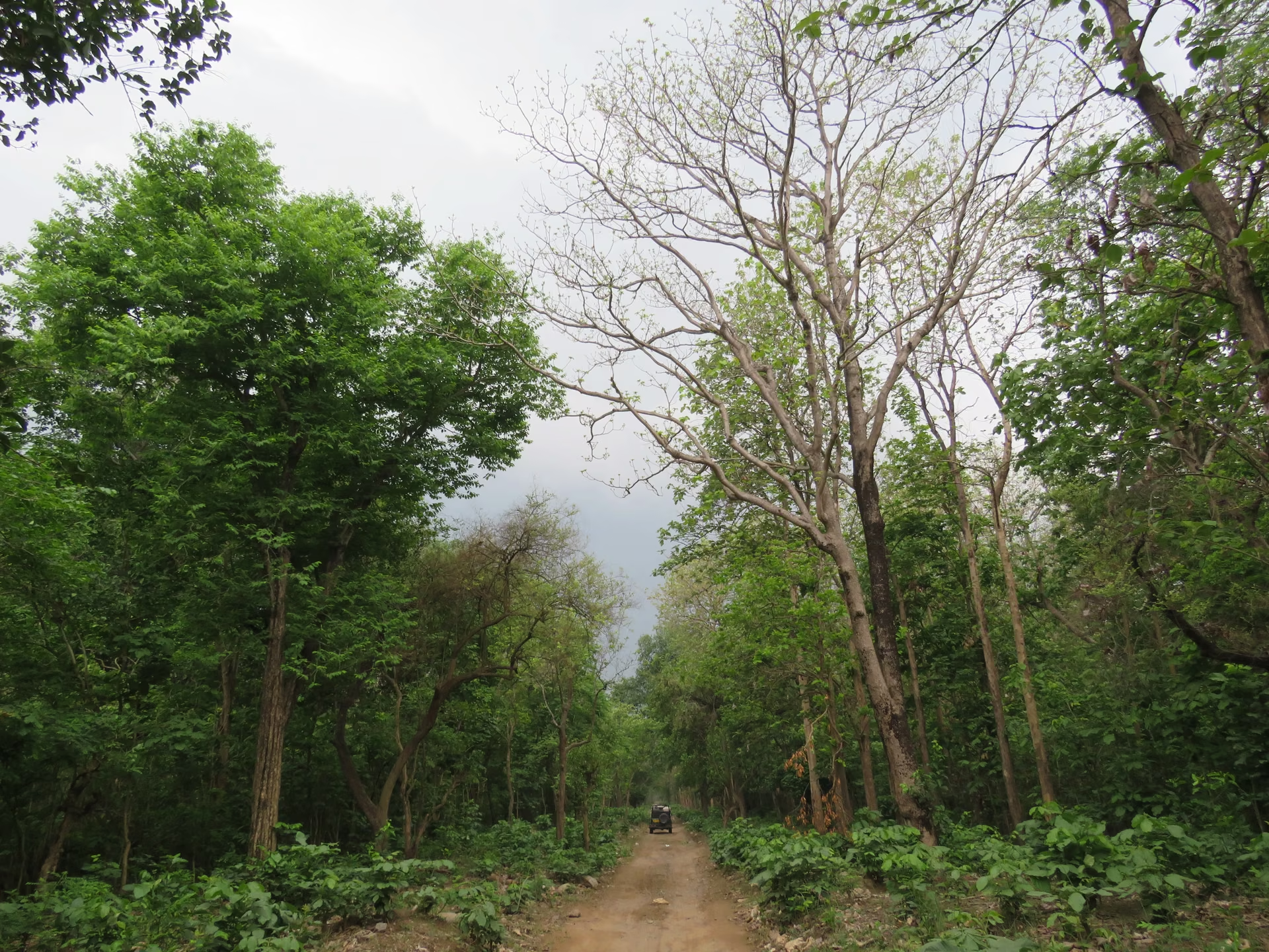
Rajaji National Park occupies a position that makes it geographically distinctive among Indian protected areas. It sits at the precise zone where the Himalayan Shivalik foothills descend into the flat Indo-Gangetic plain. This is not a random boundary — it is a landscape transition that creates a remarkable diversity of habitats within a relatively compact area. Drive through the park and you move from dense Sal forest on the hill slopes, through mixed deciduous woodland on the lower ridges, into riverine grasslands along the Ganga floodplain. The terrain shifts constantly, and with it the vegetation, the wildlife and the character of the safari experience.
Understanding this geography helps you appreciate why Rajaji supports such a wide range of species — from Asian elephants and tigers to gharials, otters and over 300 bird species. It also explains why different zones feel so different from one another. The landscape is not uniform, and your experience of the park depends heavily on which section you enter and which terrain you drive through.
The Ganga: The Park's Central Feature
The Ganga river is not just a scenic backdrop to Rajaji — it is the geological and ecological engine that shapes the entire park. The river flows through the heart of the landscape, carving valleys, depositing sediment, creating islands and floodplains, and providing water to every living thing in the forest. Without the Ganga, Rajaji would be a very different place.
How the river shapes the terrain
The Ganga enters the plains near Haridwar after descending through the Shivalik gorges. Within Rajaji, the river follows a braided path — splitting into multiple channels, wrapping around gravel bars and shifting its course over years and decades. This dynamic behaviour creates a constantly changing landscape:
- Floodplains: Flat, low-lying areas adjacent to the river that flood during the monsoon. These areas support tall grasslands — dense stands of Elephant grass, cane and reed that provide cover for elephants, deer and smaller mammals.
- River islands and sandbars: Elevated patches within the river channel that serve as basking spots for crocodiles and gharials, resting areas for turtles and nesting sites for river birds.
- Gravel bars and dry channels: Exposed during low water in winter and spring, these areas are used by elephants as movement corridors and by predators as travel routes along the river.
- Riparian forest: The strips of dense, moisture-loving vegetation along the riverbanks — including ficus trees, kapok and wild Date palm — create shaded corridors that attract wildlife, especially during hot months.
The river's influence extends far beyond its visible banks. Groundwater from the Ganga sustains vegetation across the park, and seasonal flooding deposits nutrients that keep the grasslands productive. The rivers and waterholes guide explains in detail how water availability shapes wildlife distribution across different seasons.
Tributaries and smaller streams
Several tributaries and seasonal streams feed into the Ganga within or near the park. These smaller watercourses create additional riparian habitats and serve as wildlife corridors. During the monsoon, they swell into rushing streams; in winter, many reduce to trickles or dry entirely. The variation matters: areas near permanent water sources attract wildlife year-round, while areas near seasonal streams may be productive only during or shortly after the rains.
The Shivalik Foothills: Elevation and Terrain
The park's terrain rises from the flat Gangetic plain into the first fold of the Himalayas — the Shivalik range. This is not the dramatic snow-capped Himalaya of popular imagination; the Shivalik hills are lower, rounder and densely forested. But their ecological importance is enormous. They serve as a transitional zone between the plains and the high mountains, and this transition creates the diversity of habitats that makes Rajaji so rich.
Elevation gradients
The park's elevation varies significantly from its southern edge near the Ganga plain to its northern reaches in the Shivalik hills. This gradient creates distinct vegetation zones:
- Low-elevation areas (near the Ganga): Riverine grasslands, scrubland and open woodland. These areas are generally more accessible and may offer better visibility for wildlife viewing.
- Mid-elevation areas: Dense Sal forest, mixed deciduous woodland and secondary growth. This is the classic Shivalik forest — tall trees, shaded understory and a closed canopy that filters light.
- Higher-elevation areas (toward the northern boundary): Steeper terrain with denser forest and less visitor access. These areas serve as important wildlife refuges and movement corridors.
The specific elevations and their exact boundaries should be confirmed with the Forest Department, as the park's management plans define these zones administratively as well as ecologically.
How terrain influences your safari
The terrain directly affects what you see and how the safari feels. In flat, open areas near the river, you can see across long distances — ideal for spotting elephants crossing grasslands or deer grazing in the open. In dense Sal forest, visibility is limited and the experience is more intimate — you hear birds before you see them, notice pugmarks on the track and catch glimpses of movement in the undergrowth. Different zones offer different balances of these terrains, which is why zone choice matters. The zone guide explains how terrain varies across the park's different sections.
Forest Types: What Visitors Actually Drive Through
For most visitors, the safari experience is defined by three main vegetation types:
Sal forest (Shorea robusta)
Sal is the dominant tree species in Rajaji and across much of the Shivalik range. These tall, straight-trunked trees form a dense canopy that shades the forest floor, creating a cool, dark understory. Driving through Sal forest feels like entering a cathedral — the light filters green through the canopy, the air is cooler and the sounds are muffled. Sal forest supports a range of species: deer browse on fallen leaves, langurs leap between branches, woodpeckers drill into the trunks, and ground-dwelling birds like jungle fowl scratch through the leaf litter.
Mixed deciduous woodland
Where the Sal thins or gives way to other species, you enter mixed deciduous woodland — a more open forest type with a variety of tree species, including Teak, Jamun, Mahua and various Ficus species. This woodland is more sunlit than dense Sal forest and supports different wildlife: fruiting trees attract hornbills and barbets, open areas allow deer to feed in partial shade, and the mix of tree species supports a wider range of insects and birds.
Riverine grassland
The grasslands along the Ganga and its tributaries are among Rajaji's most productive habitats. Tall Elephant grass — which can reach impressive heights during the growing season — provides cover for elephants, deer, wild boar and smaller mammals. The grasslands are also important for birds: grassland specialists like the Grass Owl, Bengal Florican (in appropriate zones) and various warblers depend on this habitat. In the dry season, when the grass is brown and shorter, visibility improves and the grasslands become excellent areas for wildlife viewing.
The habitats and flora guide provides a detailed breakdown of these vegetation types and the species they support. The birdwatching guide covers how different habitats attract different bird communities.
How Water and Terrain Concentrate Wildlife
The intersection of water and terrain is where Rajaji's wildlife dynamics become most visible. Understanding this helps you set realistic expectations for your safari:
Dry season concentration
During the drier months (roughly February to May, before the monsoon), water becomes the organising force of the landscape. Permanent rivers and waterholes remain wet while seasonal streams dry up. Wildlife gravitates toward the permanent water sources, creating concentration points where elephants, deer, boar and predators gather. For visitors, this can improve sighting opportunities in zones near reliable water — but it also means animals may be spread out in the early morning before retreating to water during midday heat.
Monsoon dispersal
When the monsoon arrives (typically June through September), water is everywhere — in streams, puddles, saturated ground and swollen rivers. Wildlife no longer needs to concentrate near specific water sources, and animals spread across the landscape. The park is typically closed or partially restricted during the heavy monsoon, but even in the shoulder months, the dispersal effect is visible: animals are present but more distributed, and sightings depend more on luck and the guide's skill than on predictable concentration points.
Winter patterns
In winter (November to January), cool temperatures and morning fog create a different dynamic. Animals are active during the warmer parts of the day, and the fog limits early-morning visibility. As the fog lifts, wildlife activity peaks — mid-morning can be productive in winter. Water sources remain reliable, and the cooler weather keeps animals active longer than in summer. The morning vs evening timing guide explains how seasonal conditions affect safari timing.
The Park's North-South Spread and Why It Matters for Gate Choice
Rajaji's geography is elongated — it stretches along the Shivalik foothills rather than spreading in a compact circle. This shape has practical consequences for visitors. The park spans a significant distance from its southern edges near the Ganga plain to its northern reaches in the hills, and different zones access different parts of this range.
Each zone has its own gate, its own access road and its own character. The Chilla zone, accessed from the Haridwar side, puts you into a section of the park with specific terrain and vegetation. The Motichur zone, closer to Rishikesh, offers a different landscape. The Rajaji range and other sections each have their own geography.
When you choose a zone, you are choosing a part of this elongated landscape. This is why zone selection matters — not just for logistics (which gate is closest to your hotel) but for the experience itself. A zone near the river will feel different from a zone in the hill forest. The zone guide helps you understand these differences and match a zone to your interests. The gates and reporting points guide maps each zone to its specific access point.
How Conservation History Shaped Today's Landscape
Rajaji's current status as a national park and tiger reserve is the result of decades of conservation effort. While the specific administrative history should be confirmed with the Forest Department or official Uttarakhand government sources, the broad trajectory is clear:
From hunting ground to protected area
Like many Indian protected areas, the Rajaji landscape was historically used for hunting by royalty and colonial administrators. The shift from exploitation to protection happened gradually through the twentieth century, driven by growing awareness of wildlife decline and habitat loss. The area was first protected as a wildlife sanctuary before being elevated to national park status — a progression that reflects increasing levels of legal protection and management attention.
Tiger reserve designation
The addition of tiger reserve status brought the landscape under the Project Tiger framework, which provides structured conservation management, dedicated funding and systematic monitoring. This does not mean tigers are everywhere in Rajaji — they are present but not frequently seen. The tiger reserve designation reflects the landscape's importance for tiger conservation, not the likelihood of sightings. The wildlife etiquette guide explains why conservation rules exist and how visitor behaviour supports these goals.
Community and corridor conservation
A significant aspect of Rajaji's conservation story involves human-wildlife coexistence. The park's boundaries border villages, agricultural land and transport corridors. Managing the interface between protected forest and human settlements is an ongoing challenge — one that involves corridor protection, conflict mitigation and community engagement. For visitors, this context adds depth to the safari experience: you are not just visiting a forest, you are entering a landscape where conservation and human life intersect daily.
What This Means for Your Safari Experience
Understanding Rajaji's geography and history transforms a safari from a simple wildlife drive into an engagement with a living landscape. When you drive through Sal forest, you are moving through an ecosystem shaped by millions of years of geological and biological processes. When you see elephants at the river, you are witnessing a relationship between species and habitat that the park's conservation framework protects. When you choose a zone, you are selecting a specific section of a landscape that stretches from the Ganga plain into the Himalayan foothills.
The practical takeaway: research the geography before you go. Understand which zone accesses which part of the landscape. Set expectations based on the terrain and vegetation of your assigned zone. And when you are in the jeep, look beyond the wildlife to the forest itself — the trees, the river, the light, the sounds. The landscape is the stage on which the wildlife drama plays out, and appreciating it makes every safari richer. The habitats and flora guide and the rivers and waterholes guide provide the detail you need to understand what you are driving through.